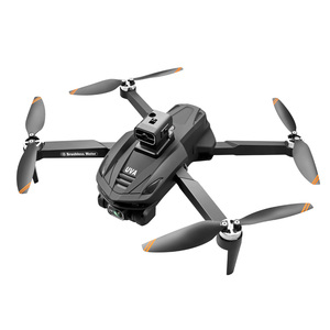
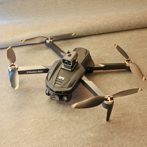
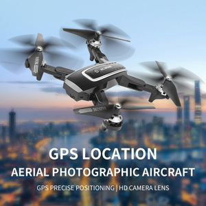
Types of GPS for drones
A GPS for drones is a system that helps to locate and navigate the drone accurately during flight. There are two main types of GPS for drones: civilian-grade GPS systems and high-end GPS systems.
Most commercial drones use civilian-grade GPS systems. These systems are usually integrated into the drone's autopilot system. They provide accurate positioning information that helps to control the drone's flight path and altitude. Civilian-grade GPS systems are sufficient for most commercial drone applications, such as mapping, surveying, and inspection.
Some high-end drone models are equipped with high-end GPS systems. These systems offer better performance and features than civilian-grade GPS. For instance, they can provide real-time kinematic (RTK) positioning with centimeter-level accuracy. High-end GPS systems are typically used in applications requiring precise positioning, such as construction, engineering, and agriculture.
When choosing a GPS system for a drone, it is important to consider the application requirements. A civilian-grade GPS system will suffice for most applications. However, a high-end GPS system would be a better choice if precise positioning is required.
Features and functions of GPS for drones
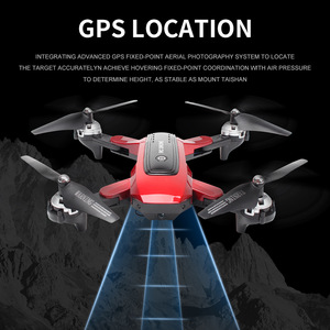
The use of a global positioning system has transformed how operators can track and manage their drones. In the past, drones would fly either visually or by referencing landmarks on the ground. This would be replaced by GPS positioning of the drone that would allow for more accurate and precise flights. Some key features and functions of GPS-enabled drones are listed below;
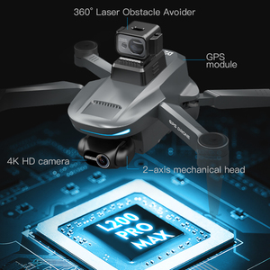
- Waypoint Navigation: This is a feature that is usually found in advanced GPS systems. It allows operators to pre-program complex flight plans with multiple points to navigate. This is used commonly in mapping and surveying applications.
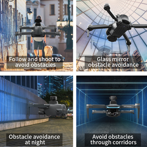
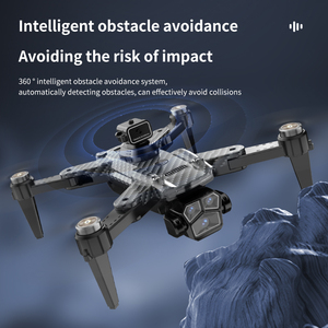
- Geofencing: This is an important feature that is usually included in GPS systems for drones. It helps with the prevention of accidents and overall safety. A GPS-enabled drone is programmed to create virtual perimeters around sensitive areas such as restricted airspaces.
- Altitude Hold: The altitude hold function allows the drone to maintain a steady altitude, which is important for achieving stable flight. This function is made possible by GPS systems detecting changes in elevation using satellite data.
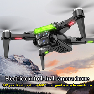
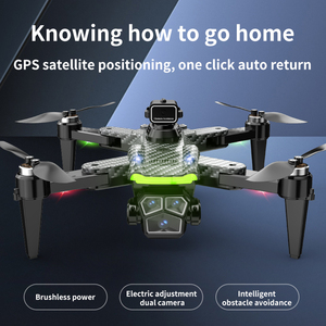
- Return-to-Home (RTH) function: This is one of the most important functions of GPS for drones. It provides a safety net for drone operators. The RTH function is usually activated when a drone encounters low battery levels, signal loss, or any form of emergency.
- Real-time tracking: This function is important, especially in circumstances where the drone has been lost. Real-time drone tracking allows for quick response efforts in locating the drone.
- Speed control: Drone speed control, flight speed, and acceleration can be adjusted and regulated depending on the nature of the operation. GPS can help in this control by providing accurate positioning data that can be used to compute the speed of the drone.
- Emergency Landing: GPS-enabled drones have emergency landing features programmed into their systems. These features detect when the drone is in distress and execute an emergency landing procedure to minimize damage or injury.
- Map-based Planning: This system works by leveraging geospatial data that is usually obtained from mapping tools. GPS for drones allows the operator to select an area of interest on a map, and the drone will fly the planned route autonomomously.
Applications of GPS for drones
Drone GPS systems have various applications. Here are some of them:
- Aerial surveying and mapping: Drones equipped with GPS and mapping software can create accurate 2D and 3D maps for construction sites, mines, and quarries.
- Agriculture monitoring: Farmers use drone GPS to monitor crop health, livestock, and land with precision drones.
- Package delivery: Drones with GPS can deliver packages from warehouses to customer locations within a short period. This helps businesses expand their delivery radius and cut down on typical delivery times. Drone package delivery is common for lightweight packages like eCommerce orders, medical supplies, and retail products. However, some companies are working on increasing their payload capacities to adjust to more packages.
- Drone inspection and surveying: GPS allows users to inspect hard-to-reach places such as power lines, wind turbines, cell towers, and pipelines quickly. They can also survey mining sites and construction locations using GPS-equipped drones. The drones can do all these tasks without needing scaffolding or cranes.
- Geofencing: Users can create virtual perimeters with the help of drone GPS-enabled geo-fencing technology. This technology can be utilized for a wide range of tasks, such as keeping drones from flying into sensitive areas and critical infrastructure and safeguarding sensitive areas like airports and stadiums.
- Search and rescue operations: In emergency situations like floods, missing people, or fires, GPS-equipped drones can provide real-time information to rescue teams. The drones can map out areas, search for missing people, and deliver life-saving supplies. Also, they can work with rescue teams to find missing persons or pets in inaccessible areas. The drones can scan large areas quickly to search for people.
- Environmental monitoring: Government agencies and environmental organizations use GPS drones to collect data on air and water quality, wildlife, and climate change. The drones can remotely monitor environmental changes and help protect natural habitats.
How to Choose GPS for Drones
-
Compatibility:
Compatibility is a crucial factor to consider when selecting a GPS system for a drone. Ensuring that the GPS system is compatible with the specific drone model being used is important. This is because different drones may have varied requirements and compatibility standards. Additionally, it's important to verify that the GPS system is compatible with any other additional equipment or accessories that may be utilized during operation. This includes items such as ground control stations and telemetry systems. Doing so will ensure seamless integration and functionality between all components of the drone setup.
-
Accuracy and Precision:
Accuracy and precision are crucial factors to consider when selecting a GPS system for a drone. The intended applications and use cases greatly influence the level of accuracy and precision required. For general recreational flying or basic mapping tasks, moderate accuracy may suffice. However, high-precision applications such as surveying, agriculture, or inspection require centimeter-level accuracy. It's essential to understand the drone's purpose and choose a GPS system that meets the accuracy standards for that specific application. Consider factors affecting accuracy, such as signal interference, satellite constellations, and augmentation systems like WAAS or EGNOS. Be aware that high-precision applications may require additional correction services, such as RTK or post-processing.
-
Range and Coverage:
Range and coverage are important factors to consider when choosing a GPS for a drone. Range refers to the maximum distance the GPS can work with, while coverage refers to the area where the GPS signal is available. Drones are used for all types of applications, from mapping and surveying to recreational flying. The range and coverage of the GPS will depend on the application. For instance, long-range drones require a GPS with a larger range and good coverage to be able to maintain signal over large areas. Similarly, mapping or surveying drones operating in expansive or remote areas may need a robust GPS with extensive coverage capabilities to avoid signal loss. On the other hand, recreational flyers within urban environments may prioritize a GPS with limited range capabilities, yet reliable performance within that context.
-
Additional Features and Functions:
Apart from the standard positioning services, other additional functions should be considered before choosing a GPS drone, in order to meet specific needs and enhance overall user experience. These may include:
Mapping and Geofencing: A drone GPS enables mapping functionalities, allowing users to create detailed maps of specific areas. This is particularly useful for applications such as land surveying, agriculture, or environmental monitoring. Additionally, GPS drones can establish geofencing parameters, which are virtual boundaries that restrict drone flight within designated zones for safety and compliance purposes.
Tracking and Recovery: Some GPS systems offer tracking capabilities, allowing users to monitor the drone's real-time position on a map. This is helpful for keeping situational awareness during flight operations. In case of an unexpected issue or loss of sight, the tracking feature aids in recovering the drone. Furthermore, certain GPS systems may include return-to-home functionality. This feature automatically commands the drone to return to its starting point if it loses signal, battery voltage falls below a certain threshold, or encounters other predefined conditions.
Compatibility and Upgradability: When selecting a GPS for a drone, it's important to ensure compatibility with the existing equipment, such as the drone itself and any ground control stations or flight controllers being used. Considering upgradability options is also wise. Technology advancements occur rapidly in the UAV industry, including GPS systems. Choosing a GPS with upgrade options allows users to stay current with the latest features and improvements without having to replace the entire system.
Q&A
Q1: How does drone GPS work?
A1: Drone GPS systems depend on satellite networks such as the U.S. GPS system or Russia's GLONASS to determine position accurately anywhere in the world. As long as there is an unobstructed signal from these satellites, a drone can get its coordinates even when flying at high altitudes.
Q2: Can I fly a drone without GPS?
A2: Yes, it is possible to pilot drones not equipped with GPS systems successfully. However, such flights may require more skill since the operator will not have access to automated positioning features provided by GPS like Waypoint Navigation or Return-To-Home functions.
Q3: What are GPS waypoints?
A3: A GPS waypoint refers to a specific location marked out using coordinates obtained from a Global Positioning System satellite constellation. These can be used for navigation purposes where one set of point coordinates will be replaced by another over time . In most drone contexts however we are talking about more than one point at a time when we refer to waypoints so that we may say that several simultaneous points, each with its own set of latitude/longitude values, allow us to program a route through the drone's geofenced area. This routing feature enables the operator to pre-program a flight path for the drone to follow, making it easier to conduct mapping or survey missions, among other applications.
Q4: How accurate is GPS on a drone?
A4: The accuracy of consumer drone GPS can vary depending on several factors, such as hardware quality, signal conditions, and environment. Typically, Positional Accuracy should be within 5-10 meters under open skies utilizing quality receiver modules.


 浙公网安备 33010002000092号
 浙B2-20120091-4